|
About
the Role of North- and
Baltic Sea
during
Winter 2013/14 and human impact!
Started on 03 January 2014, and will be continued.
|
|
1st Part (03
Jan.2014)
;
Part 2 (06. Jan. 2014);
Part
3 (12. Jan.2014)
;
'Part
4 (20.Jan14) ; Part 5
(30.
Jan.14) ,
Part 7 (22.Feb.14)
Part
6: Continental air prevented from going West!
Posted 8th
February 2014 (2007seatraing.de - 11b)
First Addendum 9. Feb
2014 >>>GO
Second
Addendum:
UK
in rain- Regional seas too warm.
(15:Feb)
>>>GO
Current
Western Europe
winter was mild, stormy, and wet. According UK-Met.Office many records
have been registered in the
UK
(Fig. 1), claiming that in
Southern England
the period
 since
mid December could be the most exceptional period of winter rainfall in at
least 248 years. Atlantic weather dominated the scene over
Europe
. High air pressure minimising the flow of warm moisture air eastwards was
hardly noticeable. A brief cold spell about 14 days ago was stopped by at
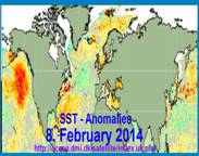
the eastern Baltic shores (see Part 5). Sea surface temperatures (SST)
Europe
’s coastal seas are still to warm for this time that prevents cold
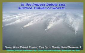
continental air to play a serious role until now. Are human activities
partly to blame for this situation? Do shipping and off-shore installation
contribute to well above SST?
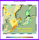
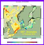
Over the few days SST developments sea areas along Danish and
German’s coast indicate a correlation. Here water temperatures are much
lower than average. But here is also shipping highest and off-shore
installation the most numerous. Holland is just completing a further wind
park with about 150
turbines, raising the total North Sea figure well above 500 (see: Part
1).
|
|
|
|
|
Fig.
2, 3. Feb. 2014
|
Fig.
3, 8. Feb. 2014
|
Fig.
4, 8. Feb. 2014
|
As air temperatures from
Oslo to Hamburg have not been low during the last weeks, the sub low SST
are likely to be caused by a different source. One needs only to recognise
the
 considerable
SST surplus from the
Dover
to the German Bight. Sun ray is still by far too weak. Any surplus is most
likely linked to heat store in the water column. A trend change is now
evident. Last year North Sea SST dropped well below average in mid March,
see Fig. 5. Will it work this year similar?
It will
not happen soon.
Baltic Sea
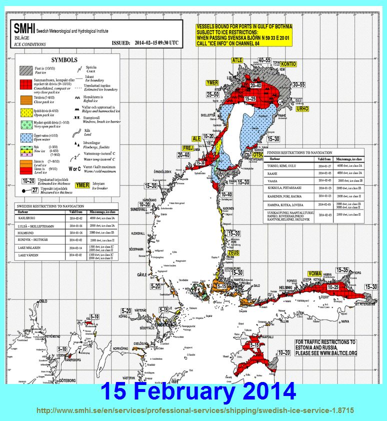
ice is below ( Fig. 6 & 7), and air temperatures well above average
(Fig. 8). It is worth to watch further developments.
Back
to Top
First
Addendum 9.Feb.2014
For
comparison:
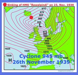
(1) A Low pressure system at
Scotland
on 23.Nov.1939
(2) Air pressure charts from 9. Feb. 1940 and 9. Feb. 2014;
and
(3) Air temperatures in
Europe
between 1940 & 2014 on 9th of February.
Fig. 9 for
comparison with Fig. 13
|
|
Extract
from Book Chapter A2 at:
www.seaclimate.com
On
November 23rd 1939 the available Royal Navy ships in the
sea area between Iceland and Scotland were deployed to hunt down two
German battleships and their escorts that had sunk the auxiliary
cruiser "Rawalpindi" south-east of Island in an earlier
encounter. During this action the air pressure over
Iceland
dropped fast and a short time later wind force increased to Beaufort
12.
|
|
What cause the big differences between February
1940 & 2014?
|
9.
February 1940 - Fig. 10-12
9.
February 2014 – Fig. 13-15
Second
Addendum:
UK
in rain- Regional seas too warm.
Posted 15. February 2014
The
United Kingdom
seems doomed by rain. The North Atlantic reigns
Western Europe
, while continental high air pressure is still hiding, and not available
to challenge maritime air to flow free eastwards. Met-Office/UK
notes that figures suggest the region of SE and Central S England has
already exceeded its record winter rainfall in the series back to 1910. It
is currently at 439.2mm*, less than 2mm above the previous record set in
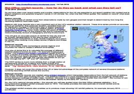
1915 with 437.1mm of rain (Fig. 16). Now rain statistics for January
indicate up to 300% rain above average (1980-2010) in Central South
England (Fig.2).
|
|
|
|
Fig.16; MetOff. Analysis “Winter 2013/14”
|
Fig. 17: MetOff. Analysis
UK
Rain January 2014
|
No
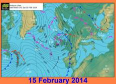
winter in sight. Today another storm passes
Great Britain
(Fig. 18).
Central Europe
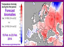
looks as if spring is starting soon (see Fig. 23). A seriously
contributing aspect is high sea surface temperatures in European regional
seas from the Biscay to the
Barents Sea
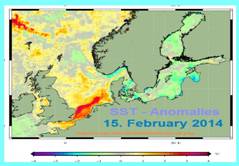
(see Fig. 4, 8th Feb.14), and Fig. 24. The high SST anomalies
in English Channel and North Sea contribute significantly to
UK
’s floods, Fig. 19. One should be interested in a query, to what extend
have this anomalies a link to human activities.
|
|
|
|
Fig. 18, MetOff. Weather map 15.02.2014
|
Fig. 19; SST anomalies
15.02.2014
|
|
|
|
|
Fig.
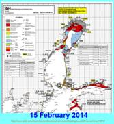
20
|
Fig.
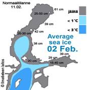
21
|
Those
may have a particularly significant impact in the Baltic. Sea ice does
almost not exist, at least well below average (Fig. 20 & 21), and the
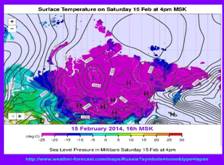
outlook offers no big changes in the near future (Fig. 22), although a
huge region east of the Ural has plenty of cold air in store. They may get
the order to march west, as soon as high SST along
Europe
’s shore weakens. It happens last year. (HERE) It is likely to happen
this year, which we would link to man’s activities in the marine
environment.
|
|
|
|
Fig.
22
|
Fig.
23
|
TOP
HOME
European
winter 2012/13 and spring 2013, documented at:
Part
1: (03
Jan.2014)
Mild
December 2013 caused by off-shore wind farms and human activities in
North- and
Baltic Sea
?
Will winter 2013/14 show an anthropogenic impact?
03 January 2014 (seatraining2007_1412a)
Part
2: (06 Jan. 2014)
Part
2: North Atlantic dominated December 2014 weather in
Europe
.
Continental Asian cold was hold at bay.
Part
3: (08 January 2014
Part
3: What will bring winter to
Europe
?
Posted 08 January 2013 (2007seatraing.de; 1412c)
+
Add 1 (12.Jan.2014) Flooding in UK
To
be continued
Home
|